Portugal is a strip of coast about 560 kilometres long and rarely more than 220
wide, so a round on the mainland comes down to how far north or south you are
and how far you are from the sea. The district is the unit that settles it, and
the two island regions are the part of the country that a map of the mainland
leaves out.
- The quiz
- Name to place, on the map
- Grouped by
- Area: the north, the centre, the Lisbon region, the south and the islands
- In the game
- 20 districts
What you are looking at
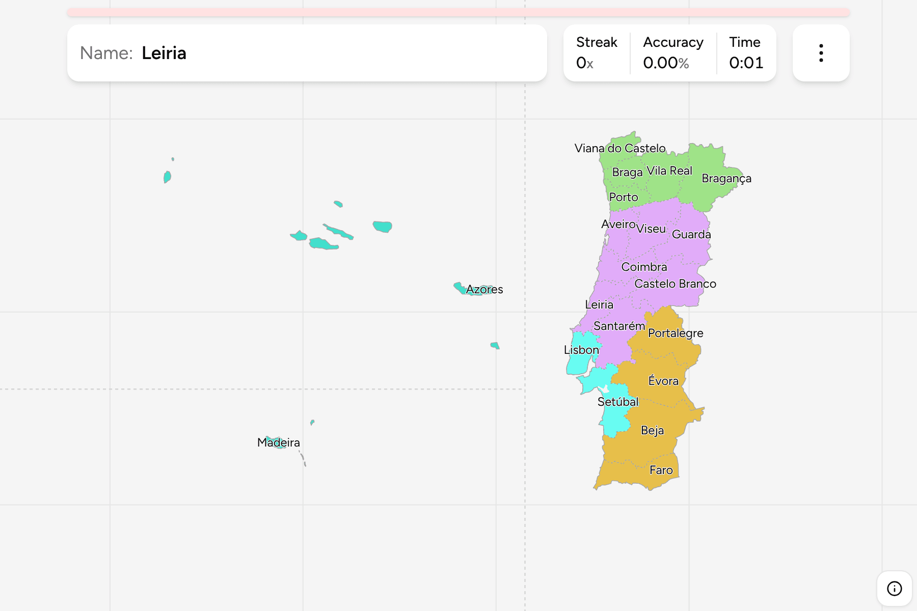
The districts (distritos) of the mainland, plus the Azores and Madeira. The
islands are autonomous regions rather than districts, and are on the map because
a quiz that left them out would leave out two of the places a Portuguese round
is most likely to land.
The Azores and Madeira are not where they are on the map. They lie one to two
thousand kilometres out in the Atlantic, so they are drawn in the sea beside the
mainland, behind a dashed rule, at their true size and with their true shapes.
The Azores are nine islands in three groups, and the answer is any of them: the
label sits on São Miguel, the largest. Madeira is the main island with Porto
Santo to its north east, and the Desertas, which are small enough that they only
show up as a few specks.
The groups are the areas people sort the country into. The north is the Minho
and Trás-os-Montes, the centre runs from the Beiras down to the Tagus, the
Lisbon region is the capital's district and Setúbal across the river, and the
south is the Alentejo and the Algarve. The districts are the
Portugal Municipalities grouped, so the borders of
the two maps match exactly.
How to place one
- Start at the Tagus. Lisbon and Setúbal sit on either side of its mouth,
and the river is the line between the centre of the country and the south.
- Read the north from the coast. Viana do Castelo, Braga, Porto and Aveiro
are the coastal band, and Bragança, Vila Real, Viseu and Guarda are the
interior behind it, which is the Spanish border.
- Find the Alentejo. Portalegre, Évora and Beja are the three large, empty
districts in the south, and Faro is the strip of the Algarve below them.
- Place the islands last. The Azores are the group in the middle of the
open sea, and Madeira is below them.
Every district, by area
- North5 districts
- Braga, Bragança, Porto, Viana do Castelo, Vila Real
- Centre7 districts
- Aveiro, Castelo Branco, Coimbra, Guarda, Leiria, Santarém, Viseu
- Lisbon region2 districts
- Lisbon, Setúbal
- South4 districts
- Beja, Évora, Faro, Portalegre
- Islands2 districts
- Azores, Madeira
Worked examples
BejaThe biggest of themBeja is the largest district on the mainland, and one of the emptiest: it is
the plain of the lower Alentejo, with the Guadiana along part of its eastern
border.
LisbonThe one that is mostly a cityLisbon is a small district, and the one with the most people in it. It is the
shape on the north bank of the Tagus mouth, and Setúbal is its neighbour
across the water.
AzoresThe answer that is nine islandsThe Azores are one answer, and any of the nine islands counts. The label is on
São Miguel, the largest and the one at the east end.
Frequently asked questions
Are the Azores and Madeira districts?
No. They are autonomous regions, each with its own government, and they sit outside the district system. They are in the quiz because they are the rest of the country.
Why are the islands drawn next to the mainland?
Drawn where they are, the mainland would be a sliver in a corner of the map. They keep their size and shape, and the dashed rule marks that they have been moved.
Do districts still matter?
As a way of saying where a place is, yes: a district is what a Portuguese address and a road map still use. The administrative work has mostly moved to the municipalities and the intermunicipal communities.
The tier below this one is Portugal Municipalities.
For another country at this level, see Spain Provinces.
Sources