Finland is a long country with few places to be in it: most of its people live
in a band along the south and west coast, and the rest is lakes, forest and then
Lapland. Knowing you are in Finland says little about where, because Helsinki
and Utsjoki are as far apart as Helsinki and Berlin. The region,
or maakunta, is the unit that fixes it. This page and the game cover all of
them, the five groups Finland itself sorts them into, and the clues that tell you
which one you are standing in.
- The quiz
- Name to place, on the map
- Grouped by
- The five major regions: Helsinki-Uusimaa, Southern, Western, Northern and Eastern Finland, and Åland
- In the game
- 19 regions
What you are looking at
A region is a statistical and planning unit, and it is the tier that Finnish
maps, weather forecasts and regional news are cut by. Each has a regional
council, a joint authority of its municipalities, which plans land use and
regional development, and a regional capital that is nearly always the biggest
city in it. Regions are not where health care is run: since 2023 that belongs to
21 wellbeing services counties, which are cut along nearly the same lines but
are a separate tier, and which are not what this game asks about.
Most regions are named for the old province they sit in or the river valley they
follow: Kymenlaakso is the valley of the Kymi and Pirkanmaa the land around
Tampere. The English names in the
game are the ones the Finnish government uses in English. They are not always
the ones older atlases print: Southwest Finland is Varsinais-Suomi, which
older English maps call Finland Proper, and Kanta-Häme is Tavastia Proper.
The Finnish names are one switch away in the start dialog.
The map is not the one of twenty years ago. Finland has had regions since the
1990s, and the number has shrunk with them. Eastern Uusimaa was folded into
Uusimaa in 2011, which is why the Helsinki region now reaches all the way east
to the border with Kymenlaakso, and other mergers and boundary changes
since have followed municipal ones. A map that still shows a separate Itä-Uusimaa
is from before 2011.
Åland is the odd one. It is an autonomous, demilitarised archipelago in the
Baltic whose only official language is Swedish, with its own parliament and its
own stamps. It is still counted as one of Finland's 19 regions, and it is the
only one that is not on the mainland.
How to place one
- Start with the coast. Most of the regions that touch the sea are in the
south and west: Kymenlaakso on the Russian border, then Uusimaa, Southwest
Finland and Satakunta along the Gulf of Finland and the Archipelago Sea, and
then the Ostrobothnian regions running up the Gulf of Bothnia to Oulu. If
you can see the sea, the answer is one of those, or Lapland at its very top.
- Then ask whether the signs are bilingual. Finnish and Swedish are both
official, and where a municipality is bilingual its road signs carry both
names. That is the south coast, parts of the south west, and the coast of
Ostrobothnia, with Åland in Swedish alone. A sign with only Finnish names
points inland, east or north.
- Then look at the land. The Lakeland, the lake district that covers the
middle and east, belongs to Southern and Northern Savonia, North Karelia,
Central Finland and Päijät-Häme. Flat, open farmland with long straight roads
is the Ostrobothnian plain on the west coast. Fells, reindeer and distances
with nothing in them are Lapland.
- Then narrow inside the group. The five groups are the fastest way to
learn them, and each can be switched on and off on its own in the start
dialog.
The traps are in the names of the Ostrobothnias and the Savonias.
There are four Ostrobothnias, and they are neighbours. From south to north
along the west coast: South Ostrobothnia, inland around Seinäjoki, Ostrobothnia
on the coast around Vaasa, Central Ostrobothnia, the small one around Kokkola,
and Northern Ostrobothnia, the large one around Oulu. Only three of them touch
the sea.
Northern and Southern Savonia are not the same shape of problem. Northern
Savonia is the larger and sits around Kuopio, and Southern Savonia, around
Mikkeli, sits between it and the Russian border to the south east. Neither
touches the sea.
Kainuu and North Karelia are not on the coast either, and both sit on the
eastern border. Kainuu is the long one in the middle, around Kajaani, and North
Karelia is the one below it, around Joensuu.
Every region, by group
- Northern and Eastern Finland7 regions
- Southern Savonia, Kainuu, Central Ostrobothnia, Lapland, North Karelia, Northern Ostrobothnia, Northern Savonia
- Southern Finland5 regions
- South Karelia, Kanta-Häme, Kymenlaakso, Päijät-Häme, Southwest Finland
- Western Finland5 regions
- South Ostrobothnia, Central Finland, Pirkanmaa, Ostrobothnia, Satakunta
- Helsinki-Uusimaa1 region
- Uusimaa
- Åland1 region
- Åland
The five groups are the major regions Finland uses for statistics, the ones
that appear on a map of the country's NUTS 2 level. Helsinki-Uusimaa is
Uusimaa alone, the capital region and the most populated, and Åland is a
major region in its own right, so those two groups are a single answer each.
Southern Finland is Southwest Finland, Kanta-Häme, Päijät-Häme, Kymenlaakso
and South Karelia, which is the south coast east and west of the capital and the
lakes behind it. Western Finland is Satakunta, Pirkanmaa, Central Finland and
the two southern Ostrobothnias. Northern and Eastern Finland is everything
else: the Savonias, the two Karelias, Kainuu, Central and Northern Ostrobothnia,
and Lapland, which together cover most of the country and hold under a quarter of
its people.
Worked examples
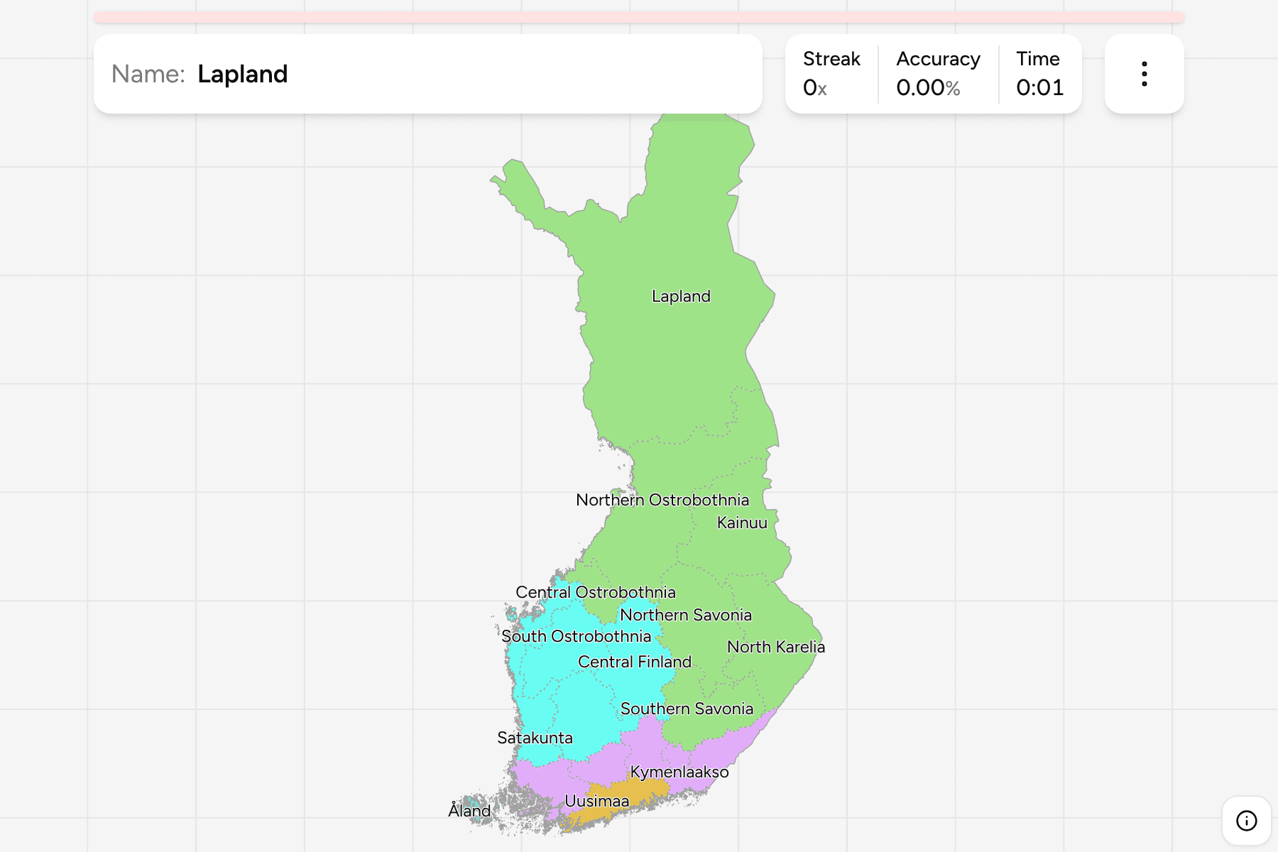
LaplandThe one that is a third of the countryLapland: by far the largest region, a little under a third of the land area of
Finland and the part that reaches north of the Arctic Circle. It is also the
least populated, and the only region where you can cross into Norway and
Sweden as well as Russia. Its capital is Rovaniemi, the one town of any size,
and if the road is long, empty and lined with spruce and pine, this is the
likeliest answer.
ÅlandThe one in the seaÅland: a scatter of islands between Finland and Sweden, with Mariehamn as its
town. It is the only region where every sign is in Swedish and the only one
that is not attached to the mainland, so it is the easy answer for anything on
a ferry route or a flat, rocky island under a very large sky.
Central OstrobothniaThe small one that goes missingCentral Ostrobothnia: a narrow region on the west coast, around Kokkola, wedged
between Ostrobothnia to the south and Northern Ostrobothnia to the north. It is
the one of the four Ostrobothnias a player is most likely to lose, because it
is small and its neighbours both share part of its name.
Frequently asked questions
How many regions does Finland have?
19, counting Åland. Eastern Uusimaa was merged into Uusimaa in 2011, which took the number from 20 to 19. The regions are not the same thing as the 21 wellbeing services counties that run health care and rescue services since 2023, although most of those follow the same lines.
What are the capitals of Finland's regions?
Helsinki (Uusimaa), Turku (Southwest Finland), Pori (Satakunta), Hämeenlinna (Kanta-Häme), Tampere (Pirkanmaa), Lahti (Päijät-Häme), Kouvola (Kymenlaakso), Lappeenranta (South Karelia), Mikkeli (Southern Savonia), Kuopio (Northern Savonia), Joensuu (North Karelia), Jyväskylä (Central Finland), Seinäjoki (South Ostrobothnia), Vaasa (Ostrobothnia), Kokkola (Central Ostrobothnia), Oulu (Northern Ostrobothnia), Kajaani (Kainuu), Rovaniemi (Lapland) and Mariehamn (Åland).
Why do some Finnish regions have Swedish names?
Finland has two official languages, and Swedish is the first language of a small minority along the south and west coast and the only official language of Åland. Uusimaa is Nyland in Swedish, Ostrobothnia is Österbotten and Southwest Finland is Egentliga Finland. The game's local names are the Finnish ones.
Is Åland part of Finland?
Yes. It is an autonomous region with its own parliament, a Swedish-speaking population and a demilitarised status that dates from 1921, and it counts as one of Finland's 19 regions.
Which is the largest region of Finland, and which the smallest?
Lapland is the largest by a wide margin, at a little under a third of the country. Åland is the smallest by area, with Kymenlaakso and Kanta-Häme the smallest on the mainland.
Which Finnish regions are easiest to confuse?
The four Ostrobothnias: South, Central and Northern Ostrobothnia, and Ostrobothnia itself, which is the one on the coast around Vaasa. Northern and Southern Savonia are the other obvious pair, and Kanta-Häme and Päijät-Häme share a word and a border.
What language are road signs in Finland?
Finnish, with Swedish names added in the municipalities that are bilingual, along the south and west coast. In Åland they are in Swedish alone, and in the far north of Lapland some carry Sámi names beside the Finnish ones.
The tier below this one is Finland Municipalities,
and the 19 regions are its groups. The other European administrative maps here
are Norway
Counties, Sweden Counties, Germany
States and Poland Voivodeships.
Sources