The district (akarere) is the second tier of Rwanda, between the five provinces
and the sectors, and the unit the government runs from schools to roads. There
are 30 of them, from the three small ones that make up Kigali to the wide
savannah districts of the east.
- The quiz
- Name to place, on the map
- Grouped by
- Province: the five of the country
- In the game
- 30 districts
What you are looking at
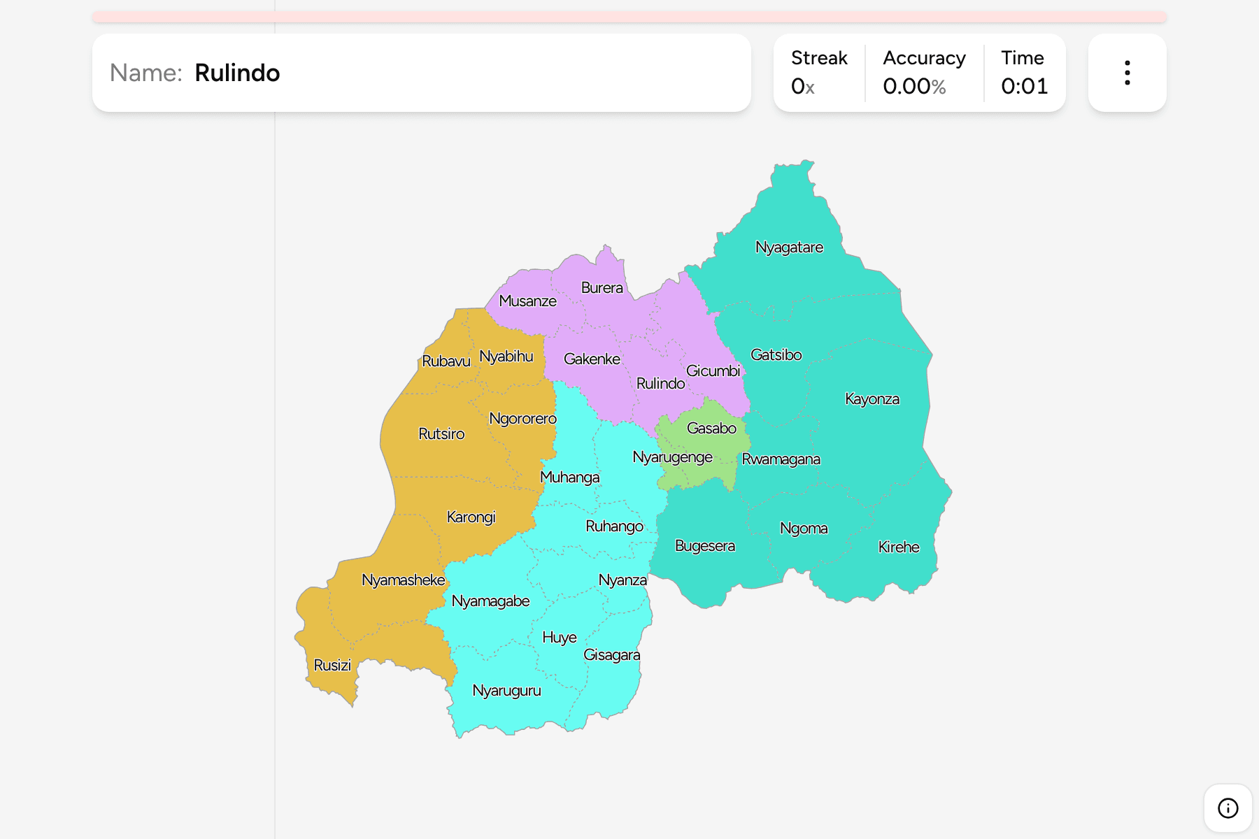
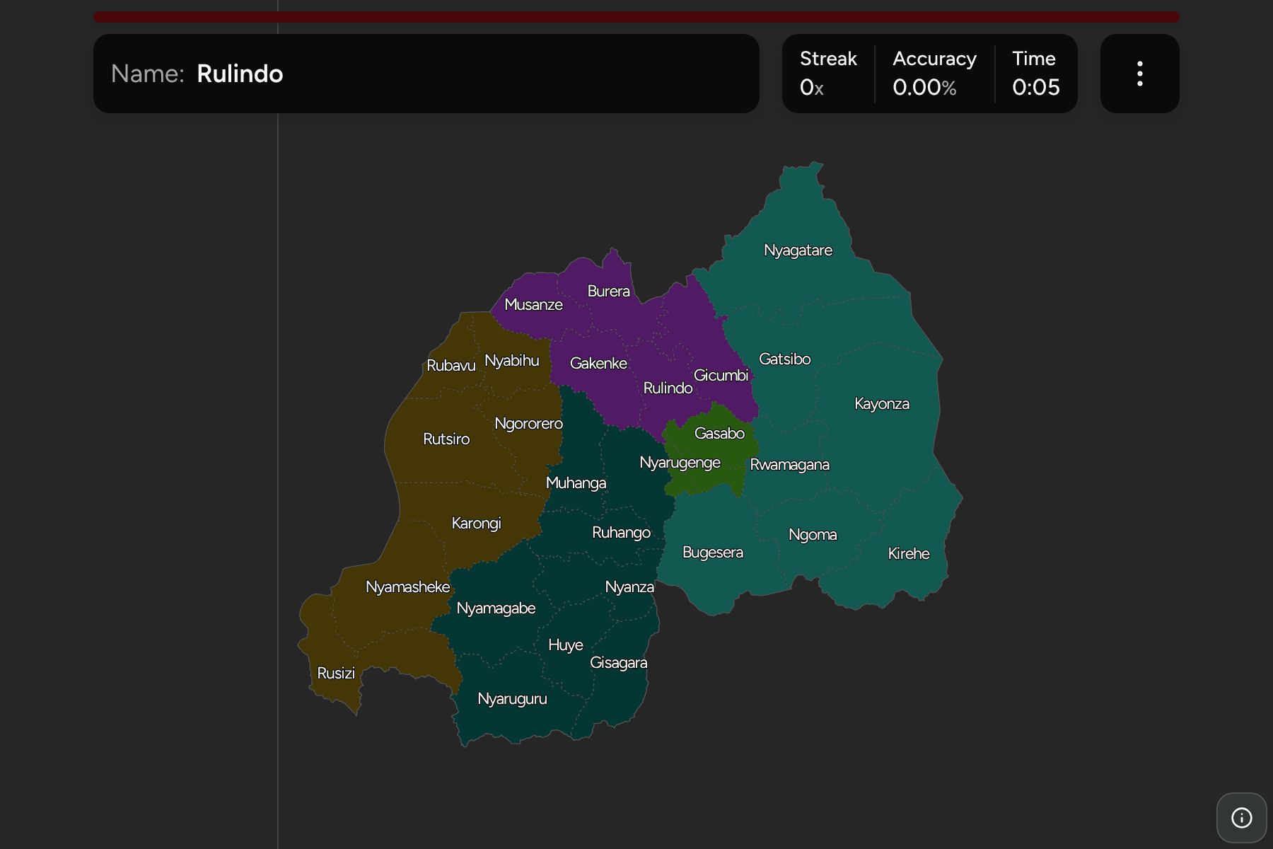
The 30 districts of Rwanda, as the 2006 reform drew them, the same year the
twelve old provinces became five. The count has held since then, which makes
this one of the more stable maps in the series, and an older map that shows
forty or more districts is from before the reform.
Several districts carry the name of the town that heads them, so Musanze,
Huye, Rubavu and Rusizi are worth knowing as places as well. Huye is the town
that older maps call Butare, and Musanze is the one they call Ruhengeri. Rubavu
was Gisenyi, on the shore of Lake Kivu, and Nyagatare, in the far north east,
is among the biggest.
The districts are uneven. In Kigali, Nyarugenge, Kicukiro and Gasabo are the
three, and Nyarugenge and Kicukiro are small enough to be given a tap area on
the map. The east is the opposite: Nyagatare, Gatsibo, Kayonza and Bugesera
are wide, flat and sparsely settled by Rwandan standards.
The groups are the provinces, so the game lets you drill them one at a time.
Each province answers under the same name in
Rwanda Provinces.
How to place one
- Pick one province and learn it. Kigali has only three and is the quickest
to finish; the Southern province has eight, the most of any.
- Start in the north. Musanze, Burera and Nyabihu are the districts at the
foot of the volcanoes, and nothing else on the map is as high.
- Follow the lake. Rubavu, Rutsiro, Karongi, Nyamasheke and Rusizi run down
the shore of Lake Kivu on the Congolese border.
- Read the east as steps. Nyagatare, Gatsibo, Kayonza, Kirehe and Ngoma run
down the Tanzanian border, with Bugesera and Rwamagana inland toward Kigali.
Every district, by province
- Kigali3 districts
- Gasabo, Kicukiro, Nyarugenge
- Northern5 districts
- Burera, Gakenke, Gicumbi, Musanze, Rulindo
- Southern8 districts
- Gisagara, Huye, Kamonyi, Muhanga, Nyamagabe, Nyanza, Nyaruguru, Ruhango
- Western7 districts
- Karongi, Ngororero, Nyabihu, Nyamasheke, Rubavu, Rusizi, Rutsiro
- Eastern7 districts
- Bugesera, Gatsibo, Kayonza, Kirehe, Ngoma, Nyagatare, Rwamagana
Worked examples
NyagatareThe biggest of themNyagatare is the largest district, in the far north east on the borders with
Uganda and Tanzania. It is cattle country, and holds the southern part of
Akagera National Park.
NyarugengeThe small one in the capitalNyarugenge is the smallest of the three Kigali districts, and holds the city
centre. It is small enough to need a tap area on the map.
HuyeThe name that changedHuye, in the Southern province, is the home of the national university and the
national museum. Many maps still call the district and its town Butare, so it
is worth knowing both forms.
Frequently asked questions
How many districts does Rwanda have?
30, spread over the five provinces.
Which province is each district in?
The quiz groups them by province, so you can drill one province at a time. Each province is its own quiz as well.
The tier above this one is Rwanda Provinces. For another
country at this level, see Senegal Departments.
Sources