Slovakia is a long country laid out west to east: the Danube plain at one end,
the Tatras in the north, and the Carpathian foothills against Ukraine at the
other. Its eight regions follow that line, so which one a place is in usually
follows from how far along the country you are.
- The quiz
- Name to place, on the map
- Grouped by
- Area: Bratislava, and the west, centre and east
- In the game
- 8 regions
What you are looking at
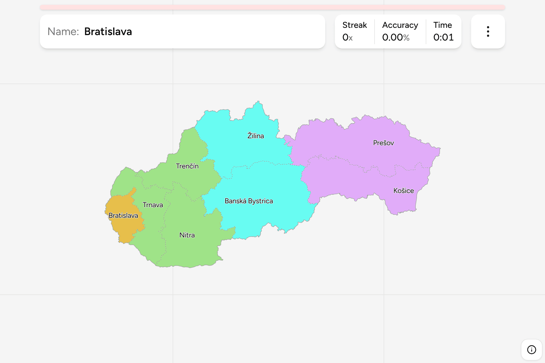
The eight kraje, each named for its largest city. Bratislava is the smallest
and sits in the far south west corner, where Slovakia meets Austria and Hungary
at the Danube, so it has a tap area wider than its outline. Banská Bystrica
is the largest and runs across the middle of the country, and Žilina and
Prešov are the two that reach up to the Polish border.
The groups are the four areas Slovakia reports its statistics for: Bratislava
on its own, the west (Trnava, Trenčín and Nitra), the centre (Žilina and Banská
Bystrica) and the east (Prešov and Košice). The regions are the districts of
Slovakia Districts dissolved, so the borders of the two
maps match exactly. The local name is a switch in the start dialog: Bratislava
is the Bratislavský kraj.
How to place one
- Start at the capital. Bratislava is the small region in the south west
corner, with Trnava directly to its north east.
- Follow the Váh. Trnava, Trenčín and Žilina line up along the river valley
as it climbs north east from the lowlands.
- Find the southern strip. Nitra is the lowland region along the Hungarian
border, and Košice is its counterpart in the east.
- Read the east as two. Prešov is the northern half of the east, up against
Poland, and Košice the southern, against Hungary and Ukraine.
Every region, by area
- Western (Trnava, Trenčín, Nitra)3 regions
- Nitra, Trenčín, Trnava
- Eastern (Prešov, Košice)2 regions
- Košice, Prešov
- Central (Žilina, Banská Bystrica)2 regions
- Banská Bystrica, Žilina
- Bratislava1 region
- Bratislava
Worked examples
BratislavaThe capital in the cornerBratislava is the only capital in the world that borders two other countries.
The region is the smallest of the eight and the one a first guess most often
gets wrong, because it is tucked against the western border instead of sitting
near the middle.
Banská BystricaThe biggest of themBanská Bystrica is the largest region, and the one that holds the geographic
middle of the country. It spans the Low Tatras and the hills of the south, and
runs from the Low Tatras south to the Hungarian border.
Frequently asked questions
How many regions does Slovakia have?
Eight, called kraje. They have existed in their present form since 1996, and each is named for its largest city.
Why is Bratislava so far from the middle?
It grew where the Danube leaves the Carpathians, at the meeting point of Austria and Hungary. It became the capital of the country in 1993, and the borders were not drawn around it.
The tier below this one is Slovakia Districts, whose
regions are the groups there. For another country at this level, see
Czechia Regions.
Sources