South Sudan is a landlocked country in East Africa, bordered by Sudan, Ethiopia,
Kenya, Uganda, the Democratic Republic of the Congo and the Central African
Republic, and it is the world's newest country, independent since 2011. The Nile
runs through the middle of it and the Sudd, one of the largest wetlands in
Africa, fills much of the centre. Its ten states are the tier everything else is
written against, and they cover the country without a gap.
- The quiz
- Name to place, on the map
- Grouped by
- Bahr el Ghazal, Equatoria and Greater Upper Nile
- In the game
- 10 states
What you are looking at
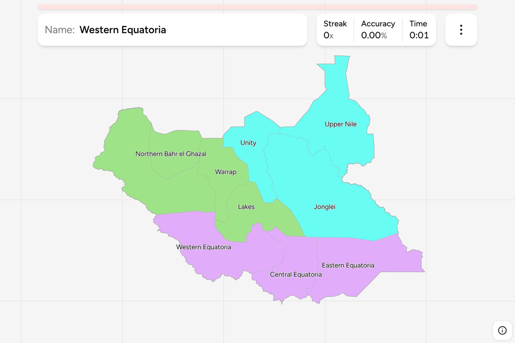
The ten states of today. The country was cut into ten states at independence,
reorganised into 28 and then 32 states between 2015 and 2020, and returned to
ten in 2020, which is why older maps and lists disagree with this one. The
administrative areas of Abyei, Ruweng and Pibor are not states and are not
drawn apart from the states around them.
The groups are not an official classification. They are the three historic
regions that the ten states map back onto, and a way to learn the map a piece at
a time: Bahr el Ghazal in the north west, Equatoria along the southern border,
and Greater Upper Nile in the north east, where the Nile and its tributaries
meet.
How to place one
- Start in the south. The three Equatoria states line up along the
southern border: Western Equatoria against the Central African Republic and
Congo, Central Equatoria around Juba in the middle, and Eastern Equatoria
running out to the Kenyan and Ethiopian edge.
- Take the north west. Bahr el Ghazal is four states. Western Bahr el
Ghazal and Northern Bahr el Ghazal sit along the Sudanese border, with
Warrap and Lakes between them and the Nile.
- Follow the Nile. Unity is the state around the great bend of the river
and the Sudd, with Jonglei to its south east and Upper Nile above both.
- Finish at the top. Upper Nile is the state that reaches up between Sudan
and Ethiopia, and Jonglei is the large one between it and Eastern Equatoria.
Every state, by group
- Bahr el Ghazal4 states
- Lakes, Northern Bahr el Ghazal, Warrap, Western Bahr el Ghazal
- Equatoria3 states
- Central Equatoria, Eastern Equatoria, Western Equatoria
- Greater Upper Nile3 states
- Jonglei, Unity, Upper Nile
Worked examples
Central EquatoriaThe capitalCentral Equatoria holds Juba, the capital, on the Nile in the far south.
Western Equatoria lies to its west and Eastern Equatoria to its east.
JongleiThe largestJonglei is the large state on the Ethiopian side, running down the east bank
of the Nile from Upper Nile in the north to Eastern Equatoria in the south.
Upper NileThe northern tipUpper Nile is the state at the top of the country, reaching up between Sudan
and Ethiopia, with Unity to its west and Jonglei to its south.
Frequently asked questions
How many states does South Sudan have?
Ten, and all of them cover land. Counties divide them further, and this game does not.
Why do some maps show 28 or 32 states?
South Sudan reorganised itself into 28 and then 32 states between 2015 and 2020, and went back to ten in 2020. A map from those years will not match this one.
Does South Sudan group its states into regions?
Not in a way this game relies on. The groups here are the three historic regions of Bahr el Ghazal, Equatoria and Greater Upper Nile, and they will not match every list you find.
Sources