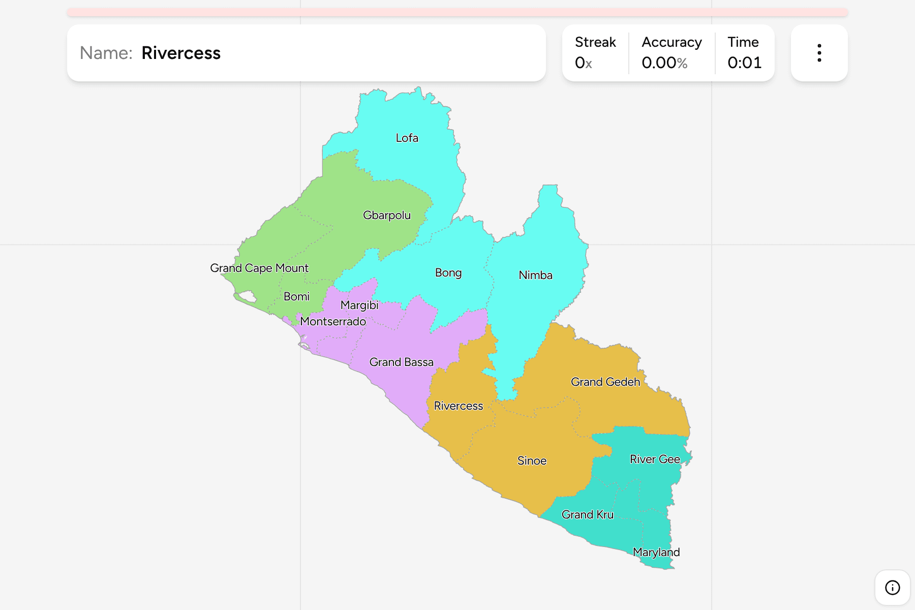
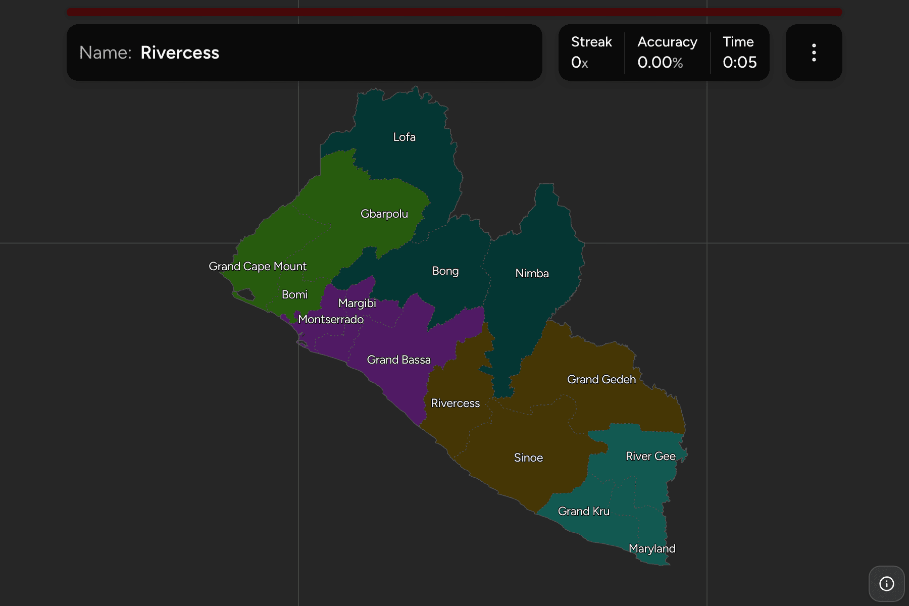
Liberia is a small country on the Atlantic coast of West Africa, and the county
is the unit that tells you where on its map you are. There are fifteen of them,
which makes this one of the quicker national maps to learn.
- The quiz
- Name to place, on the map
- Grouped by
- The five regions the national census uses
- In the game
- 15 counties
What you are looking at
The counties of Liberia, the first tier of the country. Each is run by a
superintendent appointed from Monrovia, and each is split into districts, which
are the Liberia Districts game. Most of the counties date
from the 1980s or earlier: Bomi, Grand Kru, Margibi and Rivercess were cut from
older counties then, and the newest two, Gbarpolu (from Lofa) and River Gee
(from Grand Gedeh), were created in 2001.
The map is a rough rectangle with a long diagonal coast, and the counties fall
into two bands. Along the sea run Grand Cape Mount, Bomi, Montserrado, Margibi,
Grand Bassa, Sinoe, Grand Kru and Maryland, in that order from the Sierra Leone
border to the Ivorian one. Behind them, against Guinea and Côte d'Ivoire, sit
Lofa, Gbarpolu, Bong, Nimba, Grand Gedeh and River Gee. Rivercess is the one
in between, on the coast but pushed back from it by its neighbours.
Size is no guide to importance. Montserrado is the smallest county on this map
and holds the capital and about a third of the population, while Nimba, the
largest, is mostly forest and the iron-ore mountains on the Guinean border.
The groups are the five regions the national census cuts the counties into. They
are a statistical grouping rather than an administrative tier, so use them to
drill the map a piece at a time.
How to place one
- Start with the capital. Montserrado is the small county on the coast,
with Margibi behind it and Bomi to the north west.
- Run the coast. From Montserrado south east it is Grand Bassa, then
Sinoe, then Grand Kru and Maryland at the far corner by the Ivorian border.
- Find the three northern giants. Lofa is the northern tip, with Bong
below it in the middle and Nimba to the east, along the Ivorian border.
- Fill the south east. Grand Gedeh is the big inland county, with River
Gee between it and the sea counties and Rivercess squeezed in beside Grand
Bassa.
Every county, by group
- North Western3 counties
- Bomi, Gbarpolu, Grand Cape Mount
- South Central3 counties
- Grand Bassa, Margibi, Montserrado
- North Central3 counties
- Bong, Lofa, Nimba
- South Eastern A3 counties
- Grand Gedeh, Rivercess, Sinoe
- South Eastern B3 counties
- Grand Kru, Maryland, River Gee
Worked examples
MontserradoThe small one with the capitalMontserrado is the smallest county and holds Monrovia, so it is the one every
round seems to show a piece of. It is a thin wedge on the coast between Bomi
and Margibi, and easier to find from those two than by itself.
NimbaThe long eastern armNimba is the largest county and the most recognisable shape on the map: a long
arm reaching down the Ivorian border from the north east. Its southern tip
squeezes between Grand Gedeh and Rivercess.
RivercessThe coast you cannot seeRivercess is the awkward one, between Grand Bassa and Sinoe, with a short
shoreline and an outline that leans inland. Find Grand Bassa and
Sinoe first and it is the gap between them.
Frequently asked questions
How many counties does Liberia have?
Fifteen. The last two, Gbarpolu and River Gee, were created in 2001 out of Lofa and Grand Gedeh.
Which county is Monrovia in?
Montserrado, the smallest county on this map. The city of Monrovia and its suburbs make up most of it.
Are the five groups official?
They are the regions the national census uses to report the counties in fives, not an administrative tier. Liberia has nothing between the county and the country.
The tier below this one is Liberia Districts. For another
country on the same coast, see Ghana Regions.
Sources