Burkina Faso is a landlocked country of 274,000 square kilometres on the
southern edge of the Sahel, and in 2025 its 13 regions were redrawn as 17, with
new names. Almost every map, guide and street sign you will find still shows the
old list, so the regions here are the ones a visitor is least likely to know.
- The quiz
- Name to place, on the map
- Grouped by
- North, west, centre and east, four groups of ours
- In the game
- 17 regions
What you are looking at
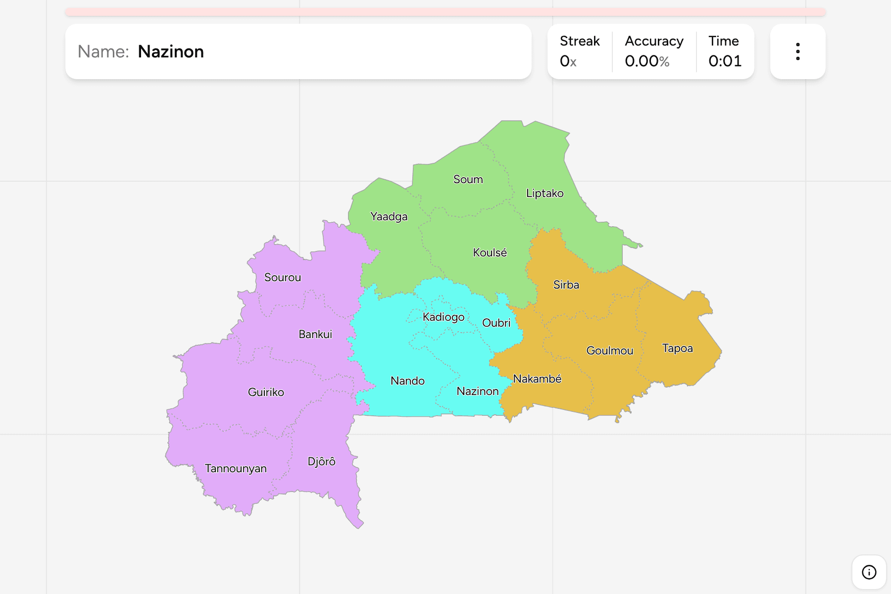
The regions of Burkina Faso, the first tier of the country. Several of the
names are rivers rather than towns: Nakambé is the White Volta, Nazinon the Red
Volta and Sourou the river on the Mali border. Kadiogo is the exception, the
capital's own region, which is one province wide.
The reform kept the old boundaries and split some of them. Boucle du Mouhoun
became Bankui and Sourou, the Est became Goulmou, Sirba and Tapoa, and the Sahel
became Liptako and Soum. The rest were renamed one for one, so Hauts-Bassins is
now Guiriko and the Centre is Kadiogo. Natural Earth and geoBoundaries still
draw the 13, and the file used here is the only one of the sources that has all
17.
The groups are ours: Burkina Faso does not group its regions, and the old 13
were mostly one new region each, so they make no use as a filter. The regions
are the Burkina Faso Provinces grouped, so the
borders of the two maps match exactly.
How to place one
- Start with the capital. Kadiogo is the small region at the centre, and
Oubri, Nazinon and Nando are the three around it.
- Take the north in a row. Liptako, Soum and Yaadga run across the top,
with Koulsé below them.
- Read the east as three. Goulmou, Sirba and Tapoa share the border with
Niger and Benin, with Nakambé inside them.
- Finish in the west and south. Guiriko holds Bobo-Dioulasso, Bankui and
Sourou lie to its north, and Tannounyan and Djôrô fill the south west corner.
Every region, by group
- North4 regions
- Koulsé, Liptako, Soum, Yaadga
- West5 regions
- Bankui, Djôrô, Guiriko, Sourou, Tannounyan
- Centre4 regions
- Kadiogo, Nando, Nazinon, Oubri
- East4 regions
- Goulmou, Nakambé, Sirba, Tapoa
Worked examples
GuirikoThe biggest of themGuiriko is the largest region, around Bobo-Dioulasso in the west, which is
the country's second city.
KadiogoThe smallest of themKadiogo is the smallest region by a wide margin, and holds the capital,
Ouagadougou.
SoumOne of a split pairSoum is the western half of the old Sahel region, and Liptako the eastern
half. Together they hold the north of the country.
Frequently asked questions
How many regions does Burkina Faso have?
17 on this map, after the 2025 reform. Older maps show 13.
Why do the names not match the ones I know?
The reform renamed the regions as well as splitting some, so Centre-Nord is now Koulsé and Cascades is Tannounyan. Maps made before 2025 use the old names.
What is below the region?
The provinces, which number 47 on this map. They are their own quiz.
The tier below this one is Burkina Faso Provinces.
For another country at this level, see Madagascar Regions.
Sources