Togo is a strip of West Africa about a hundred kilometres wide and some six
hundred long, so a round there is mostly decided by how far north you are. The
region is the first tier of that picture, and there are only five of them, one
band after another from the coast to the Burkinabe border.
- The quiz
- Name to place, on the map
- Grouped by
- The north and the south, an unofficial cut
- In the game
- 5 regions
What you are looking at
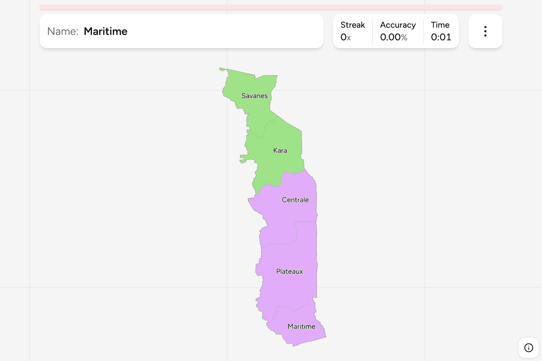
The five regions of Togo, from south to north: Maritime, which holds the short
coast on the Gulf of Guinea and the capital, Lomé; Plateaux, the green hills
inland; Centrale, the narrow middle; Kara; and Savanes, the dry north that
reaches the border with Burkina Faso.
Maritime is the only region with a coast, and it is small, but it holds the
capital and most of the country's people. Plateaux is the largest of the
southern regions and takes in Mount Agou, the highest point in Togo. Centrale
is the thinnest of the five. Kara and Savanes are the two northern regions, and
Savanes is the one at the very top.
The groups are not an official classification. Togo has no administrative tier
between the region and the country, so the quiz cuts the five into the north
(Kara and Savanes) and the south (Maritime, Plateaux and Centrale), to let you
drill the map a piece at a time. The regions are the
Togo Prefectures grouped, so the borders of the two maps
match exactly.
How to place one
- Start at the coast. Maritime is the small region at the bottom, with the
only shoreline and the capital on the border with Ghana.
- Count up in bands. Plateaux, then Centrale, then Kara, then Savanes: each
is a stripe across the whole width of the country.
- Remember the middle is thin. Centrale is the narrowest band, and the one
most often mistaken for its neighbours.
- Finish at the top. Savanes is the last region before Burkina Faso.
Every region, by group
- North2 regions
- Kara, Savanes
- South3 regions
- Centrale, Maritime, Plateaux
Worked examples
MaritimeThe one with the coastMaritime is the southern end of Togo and the only region on the sea. Lomé,
the capital, sits in its south west corner against the Ghanaian border, and
the region holds Lake Togo and the old port of Aného to the east.
SavanesThe one at the topSavanes is the northernmost region, dry savannah country along the border with
Burkina Faso. Dapaong is its main town.
Frequently asked questions
How many regions does Togo have?
Five: Maritime, Plateaux, Centrale, Kara and Savanes, from the coast to the north.
Why are the groups not official?
Togo has no administrative tier between the regions and the country, so the quiz groups the five into the north and the south by position.
What is below the region?
The prefectures, which number 39. They are their own quiz.
The tier below this one is Togo Prefectures. For another
country at this level, see Senegal Regions.
Sources