Benin is a strip of West Africa that runs from a short Gulf of Guinea coast
north to the Niger river, and the department is the unit that tells you where on
that strip a round is. There are only twelve of them, and one is a single city.
- The quiz
- Name to place, on the map
- Grouped by
- The north, the centre and the south, an unofficial cut
- In the game
- 12 departments
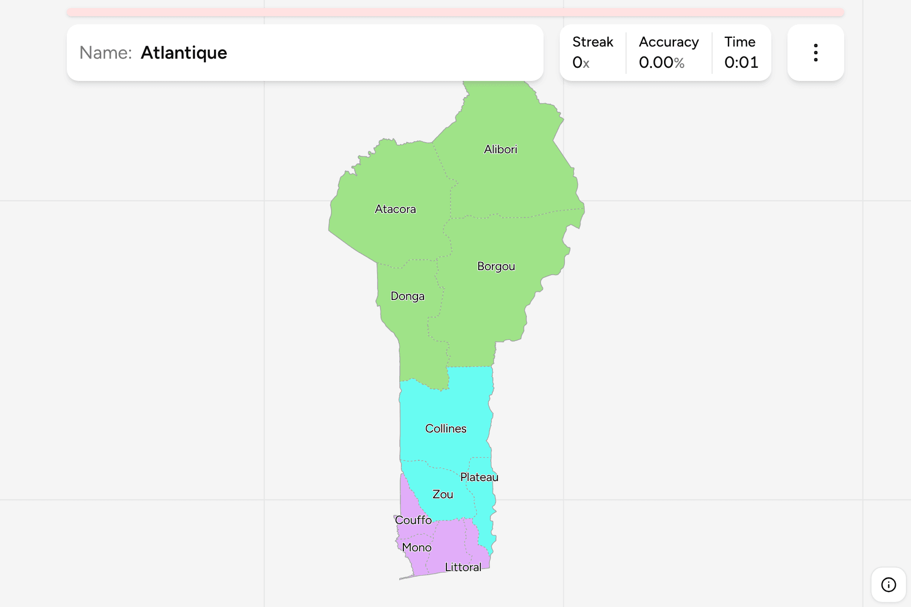
What you are looking at
The departments of Benin, the first tier of the country. Until 1999 there were
six, and each of the others was cut from one of them: Alibori from Borgou, Donga
from Atacora, Collines from Zou, Plateau from Ouémé, Couffo from Mono and
Littoral from Atlantique. That is why a map from before then looks so different,
and why a department's name often belongs to a bigger, older one.
The map is lopsided in a way worth learning. The two northern departments,
Alibori and Borgou, are by far the largest and take up nearly half of the
country between them, while the five southern ones are crowded into a coastal
strip not much more than a hundred kilometres deep. Littoral is not much more
than the city of Cotonou, which makes it a tiny answer in the middle of the
coast.
The groups are not an official classification. Benin has no tier between the
department and the country, so the quiz cuts the twelve into the north, the
centre and the south to let you drill the map a piece at a time. The departments
are the Benin Communes grouped, so the borders of the two maps
match exactly.
How to place one
- Start with the coast. Littoral is the small one on the sea, with Atlantique
behind it, Mono and Couffo to the west towards Togo, and Ouémé and Plateau to
the east towards Nigeria.
- Read the north as two big blocks. Alibori is the top of the country, on
the Niger and the border with Burkina Faso. Borgou is the one to its south,
along the Nigerian border.
- Find the mountains. Atacora is the north west, the hilly department that
borders Togo and Burkina Faso, with Donga to its south.
- Fill the middle. Collines and Zou run down the centre between the north
and the coastal south, with Plateau on the Nigerian side.
Every department, by group
- North4 departments
- Alibori, Atacora, Borgou, Donga
- South5 departments
- Atlantique, Couffo, Littoral, Mono, Ouémé
- Centre3 departments
- Collines, Plateau, Zou
Worked examples
LittoralThe city that is a departmentLittoral is Cotonou and nothing else, the economic capital and the main port,
squeezed between the Atlantic and Lake Nokoué. It is the smallest department by
a very long way, so it is the one you will most often reach for with a tap
area.
AliboriThe top of the mapAlibori is the northernmost department and the largest, on the Niger river and
the borders with Niger and Burkina Faso. Much of it is the savannah of the W
National Park, so it is empty on a round as often as it is crowded.
CollinesThe one in the middleCollines was cut from Zou in 1999 and sits in the centre of the country, in
the hills the name describes. Nothing about its outline is memorable, which is
why it is best found from the departments around it: Zou to the south, Borgou
and Donga to the north.
Frequently asked questions
How many departments does Benin have?
Twelve. There were six until 1999, when Atacora, Atlantique, Borgou, Mono, Ouémé and Zou each gave up part of their area to a new department.
Is Cotonou the capital?
Porto-Novo is the official capital, in Ouémé. Cotonou, in Littoral, is the largest city and the seat of the government.
Why are the groups not official?
Benin has nothing between the departments and the country, so the north, the centre and the south are a way to drill the map, not a classification.
The tier below this one is Benin Communes. For another
country in the region, see Ghana Regions.
Sources