Myanmar is a country of 677,000 square kilometres whose first tier splits
in two by name: the states, where the main ethnic minorities live around the
rim, and the regions of the Bamar heartland along the Irrawaddy. Which kind of
division a place is says a good deal about where it lies, so the groups below
are the way to learn them.
- The quiz
- Name to place, on the map
- Grouped by
- Regions, states and the Nay Pyi Taw union territory
- In the game
- 15 divisions
What you are looking at
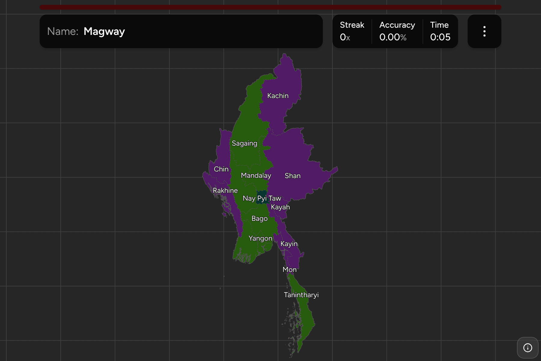
The states and regions of Myanmar, the first tier of the country. Both are
governed in the same way, and the difference is in the name: a state is the
home of a named minority (Kachin, Chin, Kayah, Kayin, Mon, Rakhine and Shan),
and a region is a division where the Bamar majority lives. Nay Pyi Taw, the
capital built from 2005, is a union territory of its own.
The source draws Bago as an East and a West half and Shan as three, North, East
and South. This map merges them back, so each of these is one answer, as it is
in the country's own count. The districts beneath them keep the borders, and the
regions are the Myanmar Districts grouped.
How to place one
- Start with Shan. The largest state fills the east, on the borders with
China, Laos and Thailand.
- Follow the Irrawaddy south. Sagaing, Mandalay, Magway, Bago and
Ayeyarwady run in a line down the middle, ending in the delta.
- Read the west as a wall. Chin and Rakhine sit between the river plain and
India and the Bay of Bengal.
- Finish at the thin tail. Tanintharyi runs down the narrow strip towards
Thailand and the Malay peninsula.
Every division, by kind
- Regions7 divisions
- Ayeyarwady, Bago, Magway, Mandalay, Sagaing, Tanintharyi, Yangon
- States7 divisions
- Chin, Kachin, Kayah, Kayin, Mon, Rakhine, Shan
- Union territory1 division
- Nay Pyi Taw
Worked examples
ShanThe state that is a third of the eastShan is the largest division on the map, a plateau along the eastern border,
and the one the source draws in three pieces.
Nay Pyi TawThe capitalNay Pyi Taw is a union territory in the middle of the country, between
Mandalay and Bago, and the seat of government since 2006.
KayahThe smallest stateKayah is the smallest state, in the hills on the Thai border between Shan and
Kayin.
Frequently asked questions
What is the difference between a state and a region?
A state is the home of a named ethnic minority; a region is a division of the Bamar heartland. Both are the same tier. The game groups them so you can learn one kind at a time.
Why are Bago and Shan one answer each?
Some boundary files draw Bago in two and Shan in three. The country counts each as one division, so this map does too.
What is below the state or region?
The districts, which are their own quiz.
The tier below this one is Myanmar Districts. For another
country at this level, see Madagascar Regions.
Sources