Sudan is built round the Nile, and almost everything in the country is placed by
how far it is from the river and which way. The state is the tier that does
that, and there are eighteen of them, plus the Abyei Area on the border with
South Sudan.
- The quiz
- Name to place, on the map
- Grouped by
- Five parts of the country, an unofficial cut
- In the game
- 19 states
What you are looking at
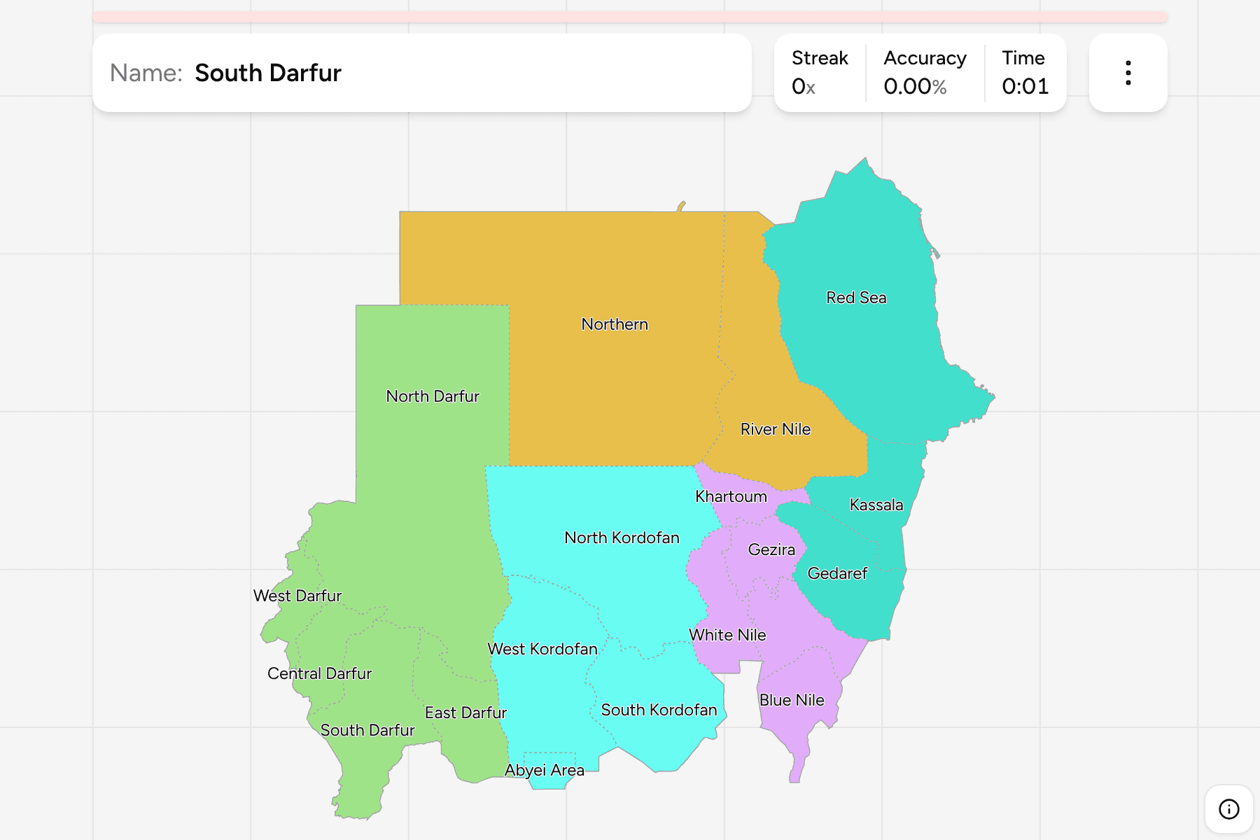
The states of Sudan, and the Abyei Area. Abyei is administered jointly with
South Sudan and is neither a state nor in one, so it is drawn as a piece of its
own, small and in the south, between West and South Kordofan.
The names tell you most of the layout. The five Darfur states fill the west, and
the three Kordofan states the middle south. The Nile runs through Khartoum, and
the states along it, River Nile and Northern, are long thin pieces of desert
that reach the Egyptian border. The Red Sea state is the coast, and Kassala and
Gedaref lie between it and the Ethiopian border.
The groups are not an official classification. Sudan has no tier between the
state and the country, so the quiz cuts them into Darfur, Kordofan, the centre,
the east and the north, to let you drill it a piece at a time. The states are the
Sudan Localities grouped, so the borders of the two maps
match exactly.
How to place one
- Start with Khartoum. It is a small state at the junction of the two Niles,
and every other state is placed relative to it.
- Follow the Nile north. River Nile is the first state beyond Khartoum, and
Northern, the largest of the long states, runs on to the Egyptian border.
- Read the west as Darfur. Five states, with North Darfur the large one on
the Libyan and Chadian border and South Darfur the most populated.
- Read the south as Kordofan. North Kordofan is the big plain, and West and
South Kordofan lie below it, with Abyei in between.
- Leave the east for last. Kassala, Gedaref and Red Sea are the three on the
Eritrean and Ethiopian side, and Blue Nile is the finger south of Sennar.
Every state, by group
- Darfur5 states
- Central Darfur, East Darfur, North Darfur, South Darfur, West Darfur
- Centre5 states
- Blue Nile, Gezira, Khartoum, Sennar, White Nile
- Kordofan4 states
- Abyei Area, North Kordofan, South Kordofan, West Kordofan
- North2 states
- Northern, River Nile
- East3 states
- Gedaref, Kassala, Red Sea
Worked examples
KhartoumThe capitalKhartoum is the smallest of the big states, at the meeting of the Blue and the
White Nile, and holds the capital, Omdurman and Bahri. It is small on the map,
so the quiz gives it a tap area.
NorthernThe one that reaches EgyptNorthern is the long desert state along the Nile bend, from Dongola to the
Egyptian border, and the largest state by area.
Abyei AreaThe one that is not a stateThe Abyei Area is a disputed pocket on the South Sudan border, held under a
joint arrangement. It is drawn as the file draws it, and kept as its own piece
rather than folded into a Kordofan state.
Frequently asked questions
How many states does Sudan have?
Eighteen. The quiz also draws the Abyei Area, which is not a state, as a nineteenth piece, because the boundary file keeps it separate.
Where do the groups come from?
They are an unofficial cut into five parts of the map, so you can drill a piece at a time. Sudan itself has no tier between the state and the country.
Why is South Sudan not on the map?
It became a country in 2011, and the map shows Sudan as it has been since. The Abyei Area on the border is still disputed.
The tier below this one is Sudan Localities. For another
country at this level, see Kenya Counties.
Sources