Tanzania is the largest country in East Africa, and its regions (mkoa) are the
unit that tells you where you are in it: the highlands round Kilimanjaro, the
shores of Lake Victoria, the long coast of the Indian Ocean, or the islands of
Zanzibar. Thirty-one of them cover the country, from Tabora and Morogoro, each
bigger than most European countries, to the five small regions of Zanzibar.
- The quiz
- Name to place, on the map
- Grouped by
- Zone: the eight planning zones of the country
- In the game
- 31 regions
What you are looking at
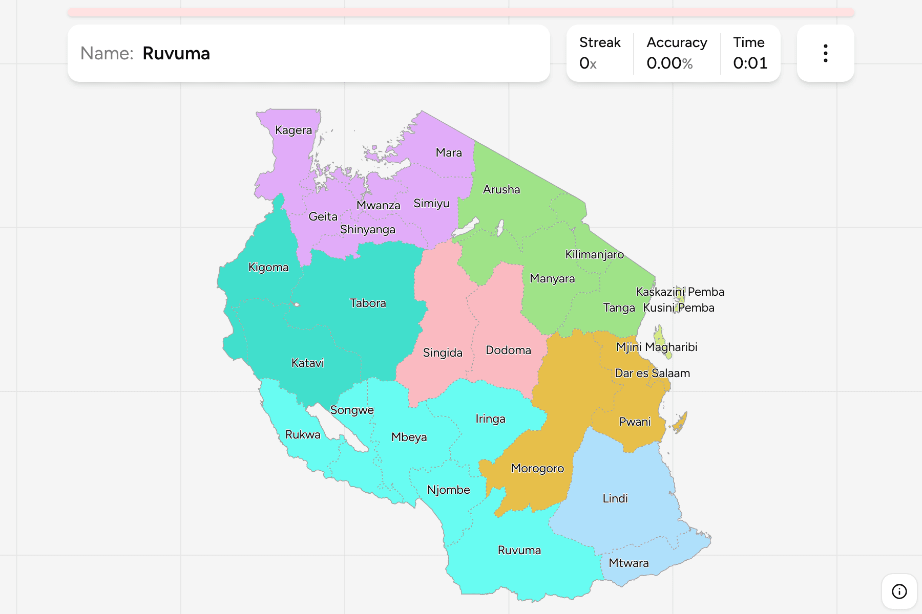
The regions of Tanzania, mainland and Zanzibar together. Names are Swahili, as
they are written on a map there. Dar es Salaam is the largest city and the
former capital, but the capital is Dodoma, in the middle of the country, and the
Dodoma region is a different answer from the Dodoma city inside it.
Zanzibar is five of the 31: Kaskazini Unguja, Kusini Unguja and Mjini Magharibi
on the main island, Unguja, and Kaskazini Pemba and Kusini Pemba on Pemba.
Kaskazini means north, Kusini means south, and Mjini Magharibi, the west and
town region, holds Zanzibar Town. They are small, and the quiz gives the
smallest a tap area so they can be reached.
The mainland counts several regions made in the last few years. Geita, Katavi,
Njombe and Simiyu were cut out of their neighbours in 2012, and Songwe in 2016,
so a map older than that shows 26. The quiz draws the 31 there are now.
The groups are the eight zones that the country's planning and statistics use:
Northern, Eastern, Central, Lake, Western, Southern Highlands, Southern and
Zanzibar. No law defines them, but they are how Tanzanians talk about the map,
and they let you drill it one piece at a time. The regions are the
Tanzania Districts grouped, so the borders of the two
maps match exactly.
How to place one
- Start with the lake. Kagera, Mwanza, Mara, Geita, Simiyu and Shinyanga
are the ring round Lake Victoria in the north west, and Kigoma holds the
shore of Lake Tanganyika in the far west.
- Find the mountain. Kilimanjaro is the small region on the Kenyan border,
with Arusha beside it and Tanga reaching down to the coast.
- Follow the coast south. Tanga, Pwani, Dar es Salaam, Lindi and Mtwara
run down the Indian Ocean, with Dar es Salaam the small one in the middle.
- Fill the middle last. Dodoma and Singida are the central plateau, and
the rest of the south, Morogoro, Iringa, Njombe, Ruvuma and Mbeya, lies
between it and Lake Nyasa.
Every region, by zone
- Northern4 regions
- Arusha, Kilimanjaro, Manyara, Tanga
- Lake6 regions
- Geita, Kagera, Mara, Mwanza, Shinyanga, Simiyu
- Southern Highlands6 regions
- Iringa, Mbeya, Njombe, Rukwa, Ruvuma, Songwe
- Eastern3 regions
- Dar es Salaam, Morogoro, Pwani
- Western3 regions
- Katavi, Kigoma, Tabora
- Central2 regions
- Dodoma, Singida
- Southern2 regions
- Lindi, Mtwara
- Zanzibar5 regions
- Kaskazini Pemba, Kaskazini Unguja, Kusini Pemba, Kusini Unguja, Mjini Magharibi
Worked examples
DodomaThe capital that is not the big cityDodoma has been the capital since the 1970s, with the government moving there
in stages, and it sits in the middle of the country. Dar es Salaam, on the
coast, is the city most visitors see and still the country's commercial centre.
Mjini MagharibiThe smallest of themMjini Magharibi is the smallest region, on the west coast of Unguja, the main
island of Zanzibar. It holds Zanzibar Town and its old Stone Town, and it is
small enough that the quiz gives it a tap area.
Frequently asked questions
How many regions does Tanzania have?
31: 26 on the mainland and five in Zanzibar. Geita, Katavi, Njombe, Simiyu and Songwe are the most recent.
Are the zones official?
No law defines them, but the country's planning and statistics group the regions this way, so the quiz uses them to let you drill a piece of the map at a time.
What is below the region?
The districts, whose councils run most local services. They are their own quiz.
The tier below this one is Tanzania Districts. For
another country at this level, see Kenya Counties.
Sources